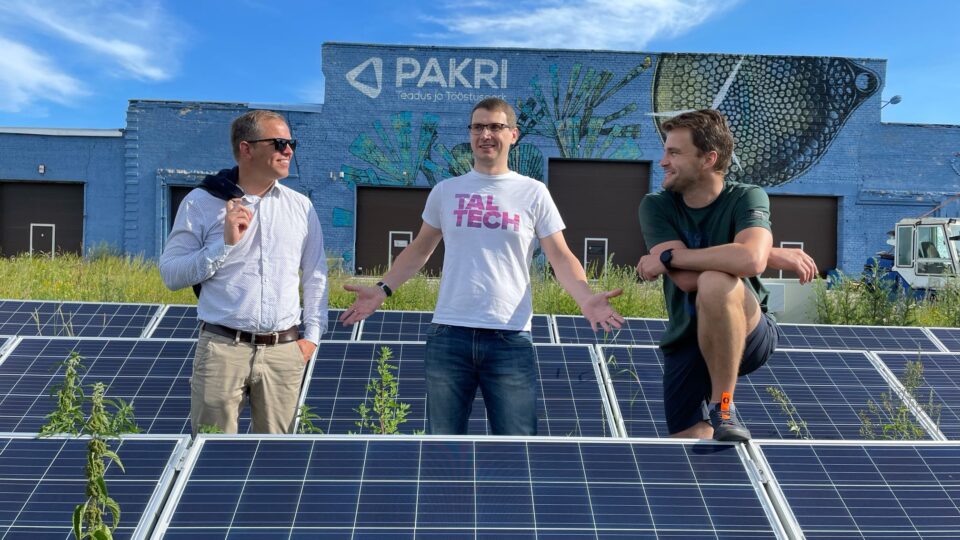
Trialoogi toimetaja
Imagine a city where the invisible world hidden beneath streets and buildings is mapped and integrated with innovative urban planning. TreeCity, one of the finalists of FinEst Centre for Smart Cities's Smart City Challenge 2024, offers exactly this.
Innovative 3D technology creates precise models of tree root systems and integrates them with digital twins of cities. The result is greener cities, healthier trees, and more thoughtful urban planning—a balance, perhaps even harmony, between nature and infrastructure.
The problem: the invisible world of cities
Beneath cities lies a complex infrastructure that includes water supply systems, electrical grids, sewage networks, gas pipelines, and even historical and geological layers. Additionally, there are tree root systems, which are essential for maintaining urban greenery. However, in practice, current urban planning often fails to consider the importance of these roots – or mycorrhiza, the symbiotic fungal networks—leading to a decline in tree vitality and, ultimately, their removal.

Kristiina Kupper, former landscape architect of the City of Tallinn and a project team member, pointed out that it is often forgotten that trees are not just trunks and canopies—they also have root systems that keep them alive. If the root system is damaged, the tree’s health deteriorates, and the tree will likely die.
Preserving trees’ health and vitality is essential not only for aesthetic reasons but also to adapt to climate change. Large and healthy trees provide shade, purify the air, and help keep the urban environment cooler during hot weather. However, their preservation becomes challenging without precise mapping of their root systems.
TreeCity: a solution that transforms urban planning
TreeCity offers an innovative solution: “Our goal is to create algorithmic 3D models of tree roots and integrate them into the digital twins of cities,” explained Eeva Henna Helena Fabritius, the project lead and senior researcher at the FinEst Centre for Smart Cities. This means that in the future, urban planners will not only be able to observe the cityscape from a top-down perspective but also visualize how tree roots extend beneath infrastructure and identify areas that are either favourable or hazardous for their growth.

Three main methods are used to create data-collecting models. One approach involves specialized scanning devices that detect underground roots and determine their density and direction. The second method allows for the removal of soil, exposing the upper roots and enabling the collection of more precise information about their positioning. Additionally, data is gathered during excavation work—when a city builds or upgrades infrastructure, it is possible to accurately record where and how tree roots are located and use this information to refine future models.
“We aim not only to map existing root systems but also to create predictive models that help forecast how the roots of different tree species will grow over time and interact with infrastructure,” added Fabritius.
“We aim not only to map existing root systems but also to create predictive models that help forecast how the roots of different tree species will grow over time and interact with infrastructure.”
Why do roots matter?
TreeCity helps cities prevent mistakes that could lead to the destruction of hundreds or even thousands of trees. Nearly 70% of trees cut down in Tallinn are removed due to poor health, mainly because their root systems have been damaged during construction work.
Additionally, planting and maintaining new trees is a significant expense. Growing a sapling into a mature tree can cost thousands of euros, meaning that every tree lost due to poor planning or project execution results in economic and ecological damage.
With precise knowledge of root system locations, urban planners can design roads, buildings, and infrastructure with minimal harm to tree roots. This leads to healthier trees, greener cities, and a more sustainable future.
TreeCity helps cities preserve trees, promotes biodiversity, and maintains urban ecosystems. “Older trees provide more habitats and are crucial for insects and lichens, which are essential parts of the city’s ecosystem,” explained Fabritius.
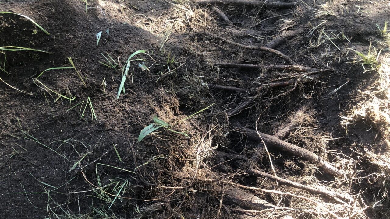
Pea 70% Tallinnas langetatavatest puudest võetakse maha puude halva tervise tõttu. Enamasti on põhjustab langetamise tõsiasi, et puujuured on saanud ehitustööde käigus kahjustada. Foto: Kristiina Kupper
Digital twins of cities shape the future of urban planning
The concept of digital twins is rapidly becoming the standard in urban planning. While these models previously focused only on buildings and infrastructure, TreeCity introduces a new dimension—natural systems. “For the first time, a 3D city model will not only display roads and pipelines but also ecosystems of living nature,” confirmed Fabritius.
According to the TreeCity team, they offer a unique solution since there has been no effective method for integrating tree roots into city models until now. “The main challenge is the lack of data—studying the underground world is difficult because excavation can damage roots. Our methods allow us to gather information about roots without destroying them,” noted Kupper.
In addition, TreeCity’s technology can improve urban construction practices. “With a precise overview of root system locations, it becomes possible to plan the installation of pipelines and cables without excavation. This is a crucial step toward urban sustainability,” added Kupper.
“With a precise overview of root system locations, it becomes possible to plan the installation of pipelines and cables without excavation. This is a crucial step toward urban sustainability.”
What’s Next?
If the TreeCity project receives funding from the Smart City Challenge 2024, pilot projects will be launched in partner cities: Tallinn, Brussels, and Helsinki. Additionally, the project has secured a potential commercialization partner, Herbarium.ai.
This international collaboration aims to develop a solution that can be used not only in Europe but on a broader scale. “If we can successfully implement this technology, it could become a global standard for cities to plan their green networks and underground infrastructure,” said Fabritius optimistically.
In the context of increasing urban density and climate change, TreeCity takes a crucial step toward a greener and brighter future.
Commentary: Martin Saarnak, BIM Coordinator at the Urban Environment Requirements Department, Tallinn Environment and Public Utilities Department
“Smart planning helps prevent damage to tree roots (including trees themselves) and utility networks during the construction phase. It is crucial that, during the design phase, the necessary volume of growth soil for root systems can be preserved or planned accordingly.
Over 60% of trees cut down in Tallinn are removed due to poor health, usually caused by damaged roots or lack of timely maintenance pruning.
Thanks to the TreeCity project, the city could make more informed decisions in the future, as almost all planning projects involve trees and utility networks. By understanding the dynamics and extent of tree roots, we can find the best locations for surrounding infrastructure elements, such as pipes, maintenance holes, and other built structures. This helps avoid conflicting situations in urban planning.”
***
Six finalists have been selected for the fourth round of the FinEst Centre for Smart Cities’s Smart City Challenge 2024. With an investment of €3.7 million, funding will be provided for up to four pilot projects focusing on developing innovative and research-intensive solutions through an interdisciplinary approach.
These projects aim to create a functional product or service and ensure scalability, enabling the developed solution to be used in multiple regions worldwide. Each project promotes international collaboration, involving at least one pilot city from Estonia and one from another country.
The four selected pilot projects will begin in September 2025.
The implementation of pilot projects is funded by the European Regional Development Fund and the Estonian Ministry of Education and Research through the project “FinEst Targa Linna tippkeskuse piloodiprogramm“.