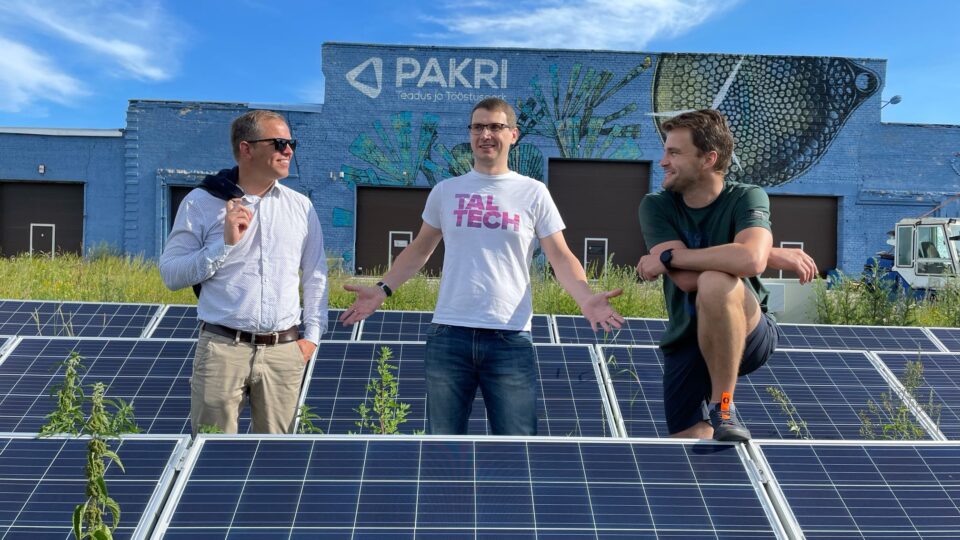
Trialoogi toimetaja
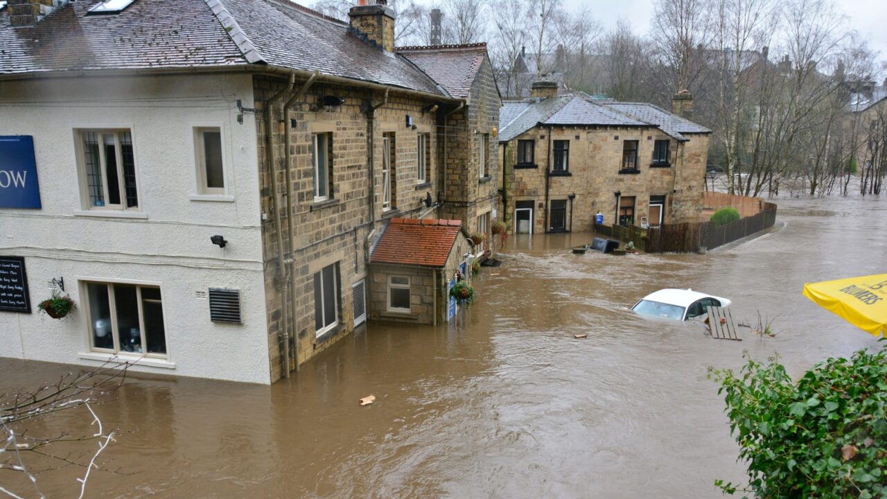
With climate change intensifying natural hazards like floods and snowstorms, cities worldwide must enhance resilience. A research team from TalTech and PUCRS, in collaboration with partner cities and commercial stakeholders, is developing a Natural Hazard Resilience Toolkit to improve crisis management through better communication and data integration.
Recognized for its impact, this project was selected as one of six finalists in an international Smart City competition, showcasing its potential to strengthen urban resilience and sustainability.
A new approach to crisis communication
At the heart of the solution is the recognition that real-time, accurate information is the most valuable resource during an emergency. Researcher for FinEst Centre for Smart Cities Dr. Luiza Schuch de Azambuja and Tenured associate professor Wolfgang Dieter Gerstlberger from TalTech emphasize that traditional crisis response methods are often slow and unidirectional. Governments and municipalities issue warnings, but the flow of information from affected communities back to authorities remains limited. The new resilience toolkit seeks to bridge this gap by facilitating both bottom-up and top-down communication. “The idea is to have a platform that integrates the communication coming from the city to the citizens and also from the citizens to the city. During emergencies, accurate information about what’s happening and where to go is crucial,“ Azambuja states.
Unlike traditional early warning systems that rely primarily on government-issued alerts, this toolkit incorporates real-time data from multiple sources, including sensors and community reports. This ensures that emergency response teams and decision-makers receive a holistic and dynamic view of unfolding crises, significantly reducing reaction times.
“The idea is to have a platform that integrates the communication coming from the city to the citizens and also from the citizens to the city. During emergencies, accurate information about what’s happening and where to go is crucial.”
Beyond flooding: a comprehensive resilience toolkit

Although initially focused on floods, the project has expanded to encompass a variety of natural hazards. In Estonia, for example, heavy snowstorms often block roads and disrupt logistics, while in Brazil, extreme floods pose life-threatening risks. The modular nature of the toolkit ensures that it can be scaled and adapted to different geographical and climatic conditions.
“We need to find a modular way to address different risks. A small city in Eastern Europe will have different needs compared to a major urban center in Brazil or Germany. Yet, all of them require a more efficient response mechanism,“ says Gerstlberger.
A key aspect of this adaptability is the ability to integrate with existing local solutions. In Porto Alegre, Brazil, for instance, an existing municipal app already serves as an emergency communication tool. Instead of replacing it, the toolkit can be embedded within the existing infrastructure, ensuring seamless accessibility. In cities without a dedicated emergency app, the platform can function independently through a browser-based system.
Harnessing the power of data and community intelligence
The toolkit integrates data from multiple sources, including sensors that monitor water levels and weather conditions, as well as citizen reports from affected areas. The use of community intelligence (CCI – Collaborative and Community Intelligence) allows for a more dynamic response. Residents in affected zones can submit real-time updates, such as flood levels or blocked roads, which are then validated through geolocation and multimedia evidence. “People on the ground often have valuable information before official warnings are issued. By engaging the community, we can improve situational awareness and decision-making,“ Azambuja explains.
“People on the ground often have valuable information before official warnings are issued. By engaging the community, we can improve situational awareness and decision-making.”
This decentralized approach could significantly reduce response time in emergencies. As seen in the devastating floods in Spain and France last year, delays in communication can have fatal consequences. “It always takes too long. The idea is to speed up the process and use all available data sources to inform citizens and authorities in real-time.“
Developing and implementing this solution is not without its challenges. The project must integrate multiple layers of data, including sensor measurements, crowd-sourced reports, and existing governmental databases. Ensuring data accuracy, privacy, and cybersecurity is another major hurdle.
Additionally, the social aspect of disaster preparedness is critical. In Porto Alegre, for instance, last year’s catastrophic flood was unprecedented, leaving many residents unprepared. “People didn’t believe the official warnings, and many refused to evacuate,” recalls Azambuja. “Raising awareness and training communities on how to respond is just as important as the technology itself.”
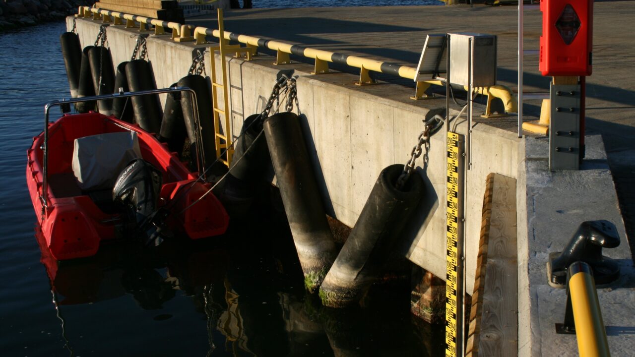
Smart buoys, or autonomous marine measurement stations, transmit data at five-minute intervals and assist ports and vessels in making critical navigation decisions. Photo: Kaimo Vahter / Institute of Marine Systems
Making the solution sustainable
The long-term success of the resilience toolkit depends on a viable business model. Various funding avenues are being explored, including subscriptions, donations, and advertisements. Municipalities are expected to be key clients, but financial constraints vary widely. While wealthier cities such as Hamburg may allocate significant budgets for disaster preparedness, smaller municipalities in Brazil may require governmental or international support.
Insurance companies and urban planners could also benefit from the system’s predictive analytics and risk assessment capabilities. As natural disasters result in billions of euros in damages annually, insurers may find value in accessing more precise risk data.
The project is currently in the validation phase, with ongoing discussions with pilot cities—Haapsalu and Kuressaare in Estonia, and Porto Alegre in Brazil—to tailor the solution to their specific needs. Researchers are conducting interviews with stakeholders, rescue teams, and municipalities worldwide, including potential partners in Indonesia and Germany.
As climate change continues to exacerbate the frequency and severity of natural hazards, cities must adopt more intelligent and adaptable crisis management solutions. The Natural Hazard Resilience Toolkit offers a data-driven, community-powered approach that enhances both preparedness and response. By integrating sensor technology, social media intelligence, and local community engagement, this project represents a promising step toward a safer, more resilient future for cities worldwide.
As Professor Gerstlberger aptly puts it, “It’s not about reinventing the wheel—it’s about making it turn faster and more effectively when disasters strike.”
“It’s not about reinventing the wheel—it’s about making it turn faster and more effectively when disasters strike.”

Dr. Luiza Schuch de Azambuja, a researcher at the FinEst Centre for Smart Cities, explained that the toolkit gathers data from various sources — sensors measure water levels and weather conditions, while residents can report what is happening in their area. Photo: Private collection
Comment — Kairi Niit, Head of the Environmental Department at Saaremaa Municipality Government:
“A thorough analysis was conducted at the national level to map flood risk areas, and Saaremaa Municipality was involved in the process. This information has also been incorporated into the preparation of Saaremaa’s comprehensive spatial plan.
National efforts have paid less attention to the flood risks posed by inland water bodies — a rise in sea level and periods of high water can cause significant flooding from the Põduste and Tori rivers in the town of Kuressaare. The nature of the challenges depends on the causes and accompanying factors of the flooding, such as storms, heavy rainfall, snowmelt surges, ice conditions, and resulting issues with accessibility, restoring power outages, and ensuring the delivery of essential services.”
Gunnar Havi, Crisis Preparedness Advisor at Saaremaa Municipality Government:
“In terms of flooding, inland water bodies don’t cause us much concern by themselves. Rather, a high sea level can reverse the flow of the Tori and Põduste rivers. We have taken into account the areas where the water level could rise by up to two meters.
Currently, the main method for data collection is visual observation. Water level gauges exist in the harbors of Kuressaare, but they are also monitored visually, and the municipality doesn’t use any sensors or other devices to issue alerts. Rising water levels are assessed based on weather forecasts provided by the Estonian Environment Agency.
Crisis management processes are in place, and in general, there are no issues with collecting or sharing information. Since parts of Kuressaare are located within the flood risk area (2 m rise), people monitor water levels closely themselves, but certain sensors might offer a better overview.
The main expectation for the solution being developed is that the information is timely and allows for action to be taken. If the installed devices and sensors can improve crisis management processes even further, then that would be a success.”
***
Six finalists have been selected for the fourth round of the FinEst Centre for Smart Cities’s Smart City Challenge 2024. With an investment of €3.7 million, funding will be provided for up to four pilot projects focusing on developing innovative and research-intensive solutions through an interdisciplinary approach.
These projects aim to create a functional product or service and ensure scalability, enabling the developed solution to be used in multiple regions worldwide. Each project promotes international collaboration, involving at least one pilot city from Estonia and one from another country.
The four selected pilot projects will begin in September 2025.
The implementation of pilot projects is funded by the European Regional Development Fund and the Estonian Ministry of Education and Research through the project “FinEst Targa Linna tippkeskuse piloodiprogramm“.